In August of the 16th year it was succeeded to make an automobile trip on northern coast of Lake Baikal.
Prepared the car, the trailer with all srub and early in the morning started from Boguchansky district towards Kodinsk, on the good grader along the Angara River, reached very quickly. Further us 250 km old concrete trough valleys Kodinsk-Bratsk expected the Boguchany hydroelectric power station laid even for construction. By the way, Yandex Maps claim that you will eat up by car in some 4 hours, don't believe!
By Admin, Aug 16, 2015 in Jeeping
Travel on the jeep long in the sum of 2400 Km, 600 km along the Baikal-Amur Mainline
The road from the moment of construction probably wasn't served at all, on certain sites it went huge waves, plates dispersed rather widely and for cars the road becomes more and more problem, for the normal jeep everything is quite good, it is possible to go quickly. From Kodinsk Bratsk reached in 5 and a half hours, and by this moment we already tore off a bracket of the forward stabilizer of cross stability, it was necessary to look for spare parts and to be repaired. By the way, the stabilizer on a way back after all burst.
Having had supper the trip proceeded towards Ust Kut, from Bratsk good there (and taking into account further, in general ideal) is expensive, there are repairs and buildings, asphalt becomes more and more, not really there is a lot of cars. Behind each turn of the road very picturesque places meet.
Photo, river Ilim

There is a reconstruction of the bridge through Ilim river.


We move further on the valley of the river Kuta. Behind one of small passes the beautiful view of Semigorsk opens

These places began to make habitable in 17 m a century. On an example around 1628 Cossack Vasily Bugor, from the Yenisei ostrog, passed with group for the first time down the river of Kuta to Lena and based winter quarters. Today these places the railroad winds

In the place of confluence of Kuta and Lena it based winter quarters, and in 1631 by results of the previous expedition the ataman Ivan Galkin put a ostrog Ust Kut.

In 1633 Erofey Habarov got arable lands, delivered horses and below across Lena reconnoitered the salty lake on which constructed the salt plant later and in several years it provided with salt all settlements up to Yakutsk. The saline plant of Habarov worked till the XX century, approximately in 1908 properties, more valuable to the time, became clear behind a source. Water was curative: hloridno-sodium with the increased content of radon, polyarthritis, rheumatism, radiculitis, diseases of cardiovascular and nervous system treats. By that moment the salt lake already dried up.

Darkened, we leave the town and having moved the Lena River we begin to overcome the first passes (about 600 meters in dive) and kilometers of the official Baikal-Amur Mainline. We should overcome the 350th kilometer distance from Ust Kut to Severobaykalsk on not the best road. Builders BAM stormed these places in severe conditions with a frost under-50 since January 9 and already on January 19, having passed 30 km left to Tayur's station (Star). By the way, keep in mind that there are practically no gas stations throughout the road to the coast of Baikal. After Ust Kut the next will be through 170 km only in the settlement Mainline's.


Nearby on the mountain a monument to pioneers of BAM.
The route goes along the railway line winding on valleys and ridges periodically it all the time jumping, on a perezda, on the overpass. Cars out of settlements practically ceased to meet.
The road represents the rolled gravel grader, sometimes so bad that even on the jeep you go 40km\h, and occasionally, near settlements with interesy names of Niya, Nebel, "pieces of happiness" of an asphalt covering and speed joyfully meet rises to 100km\h, continuous jolting stops.
Have a sleep several hours in the settlement Mainline and from the dawn moved forward on a final piece of the road. It became clear a bit later that to drive this piece during daylight hours was the correct decision. After Ulkan, Davan is closer to the pass, the road became covered by large boulders and a cap rock, speed fell to 20-35km\h, big pools and fords occurred at the destroyed bridges through mountain streams. As here go local by cars I don't represent!? Somewhere on these stones from jolting jammed focus on the lens Canon EFS 17-85 USM (in a consequence successfully repaired by own efforts).


Numerous moving through BAM, caps of mountains in clouds


On the road types open one more beautiful another, only and manage to stop and make a photo


I don't know why, but for me was opening that BAM passes through such picturesque valley. Behind each turn and the pass fog hides, shows mountain peaks. Very much impresses!


From the pass about 1000 m high Davan smart types open! You stop each 500 m to make the next picture


Sites meet various holes. It is very dangerous to go quickly even on the prepared jeep, witnessed that people on Nissan Patrol went to a good ditch, and it is good that without consequences. Stopped, unfortunately, to help them than couldn't except how to leave means from midges and mosquitoes. A ditch there stony to hook on the winch no trouble it is perfect, and the jeep was threateningly hung out that to extend them KAMAZ or the Urals and the benefit is necessary such transport quickly appeared. And it in the summer!

Happen and new pieces are expensive, generally on the site the pass Davan-Severobaykalsk. The railroad runs through the Davansky tunnel now

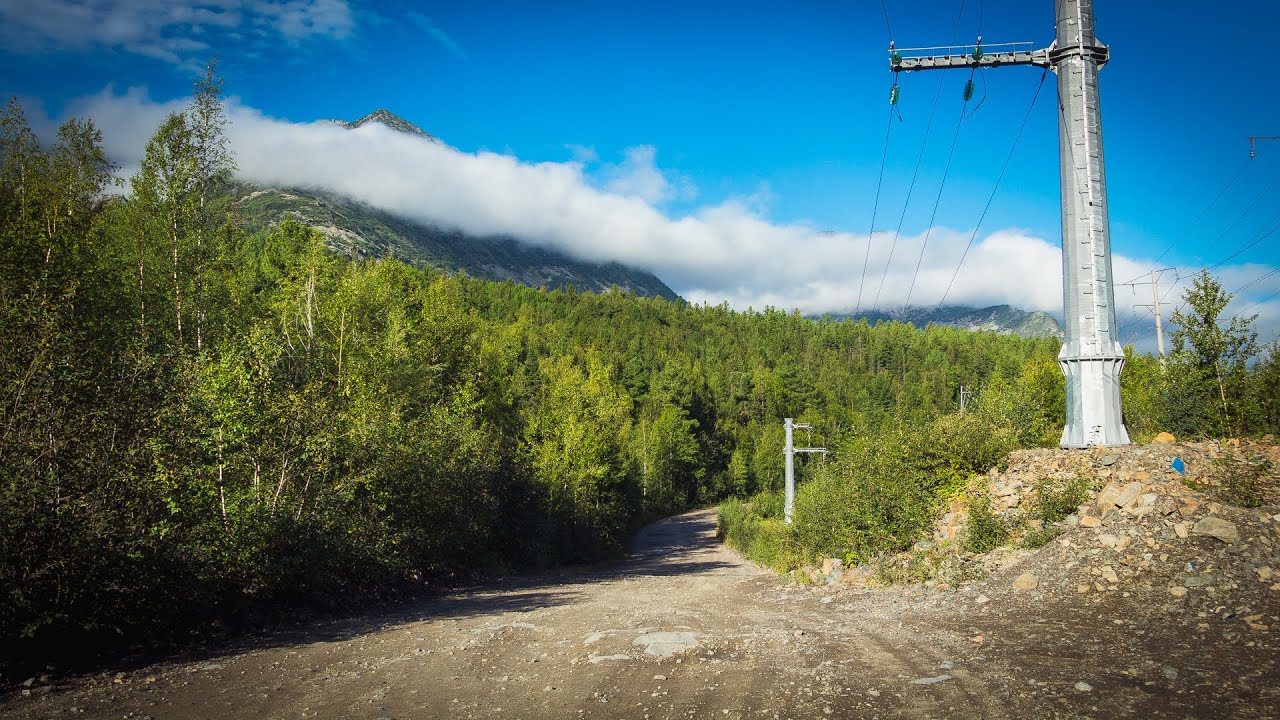
Power line support, unusual in form, in the basis 2-3 grasps thick.

Mountains are beautiful, abound with streams and river cascades

By 8 in the morning reached the settlement at the station Goudzhekit, total in way nearly 24 hours turned out. Became populated on a camp site, bathed in a hot spring and were filled up to sleep, without having seen around nothing. Water in a source very interesting, rich with any minerals, temperature somewhere of degrees 50 also leaves on skin a thin slippery mark similar to soap. Long it is difficult to swim in the pool with such temperature, it is necessary to leave and take a contrast shower.
And is closer to a lunch cleared up and from a verandah of number such look opened...

Having had a dinner, went to the purpose of our trip to Lake Baikal. Along the mass of mountain small rivers are expensive.
River Tyya


Numerous bridges of BAM. Generally all in good shape and after repairs.

From a survey point on entry into Severobaykalsk, it is visible not at once where the lake as on the horizon of the mountain merge with the sky and in smoke air from the fires, and the lake in this place 35 km wide. The summer weather pumped up a little, but the wide smooth surface of the lake opens. Photos from this point because of a lens went to a basket.


Fishing on the Baikal Omul very interesting occupation. On a spirit and flies of a tackle are similar to those that for a grayling, but only here everything occurs at distance of meters 100 from the coast, at a depth about 16 meters. Buryat fishermen benevolent people, explained and showed everything, even allowed to use the tackles on test. Because of weather and a problem with the motor by the boat we managed to fish not really much, caught only 3 ordinary omuls. The tasty small fish, is strongly similar on a grayling.

The observation deck near Severobaykalsk, a view of a bay and the Slyudyanka lakes

View from a coastal meadow on the previous shot, the observation deck at the left off-screen

Visited the Slyudyanka lakes, the good place equipped for rest. The selfie stick have a useful not documented property, by means of it it is possible to force down cones from a cedar and to regale on them!

Places are so remote that on the route it is possible to meet also a bear

In one of days, went on the most northern point of Baikal located in Nizhneangarsk.
The road between Severobaykalsk and Nizhneangarsk.


Northernmost tip of the lake, Nezhneangarsk dam


Colourful sunsets


Panorama from the most northern point of Baikal

To Severobaykalsk the small accurate town, interesting architecture of the railway station, on a board the heap of trains and life boils. The center tried a local dish - poses (buuza), it is similar to khinkali and manti combined. Eat them peculiar, biting off an edge and pouring out broth in a spoon which you bite, you chew and you wash down. Food prices are average.
Today, on all piece of Ust-Kut - Severobaykalsk the Baikal-Amur Mainline, goes reconstruction of railway tracks and their expansion to two-acceptable, At the Davansky tunnel the driving of the second branch which will be put in operation to the middle of 2017 is also begun.
The way back ran more quietly, all places and sites are already familiar, with spending the night stopped at Bratsk, and next day slowly reached to a starting point.
By Admin, Aug 16, 2015 in Jeeping
Route: Boguchany, Kodinsk, Bratsk (Brotherly hydroelectric power station), Ust Kut, Severobaykalsk. Travel on the jeep long in the sum of 2400 Km, 600 km along the Baikal-Amur Mainline
Additional:
Source: